
[Uk] Storm Agnes: What do you need to know?
Image source, Getty ImagesImage caption, Storm Agnes expected to bring rough conditions to Irish Sea coastsBy Simon KingBBC WeatherThe first named storm of the autumn and winter season is expected to hit the UK and Ireland on Wednesday.Named by the Met Office, Storm Agnes is likely to bring some disruption from strong winds and heavy rain.Met Office severe weather warnings are in force from Wednesday afternoon until Thursday morning.The strongest winds are likely around Irish Sea coastal areas with gusts up to 75mph (120km/h).The storm was named after a deep area of low pressure developed in the Atlantic, enhanced by some energy from ex-tropical storm Ophelia which hit the north-east coast of the US over the weekend.Image caption, Storm Agnes is a deep area of low pressure coming in from the AtlanticWarning for wind and heavy rainThe Met Office has issued yellow severe weather warnings for wind from 12:00 BST on Wednesday through until 07:00 BST on Thursday morning.While there are a fe
![[Uk] Storm Agnes: What do you need to know?](https://www.9020blog.com/uploads/images/202309/image_750x_6512c6c86af73.jpg)
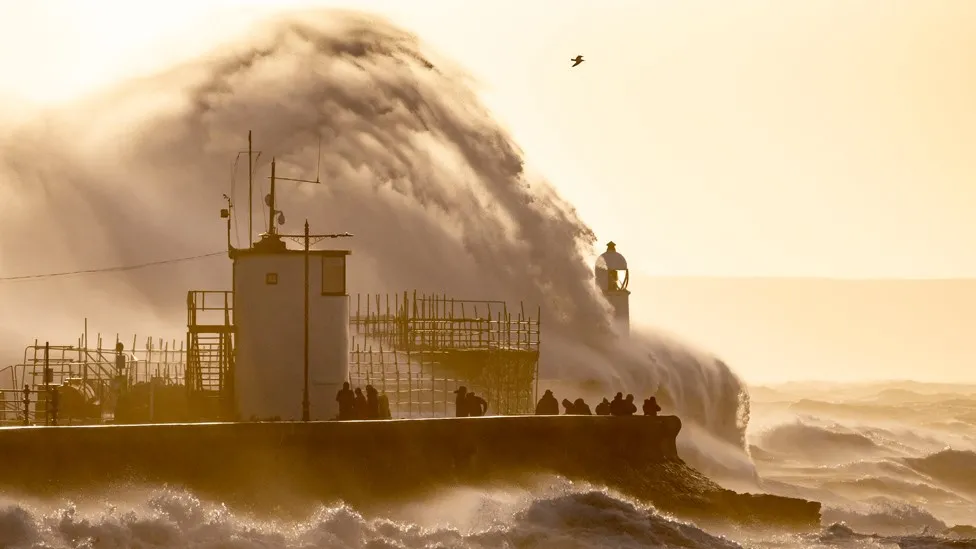
The first named storm of the autumn and winter season is expected to hit the UK and Ireland on Wednesday.
Named by the Met Office, Storm Agnes is likely to bring some disruption from strong winds and heavy rain.
Met Office severe weather warnings are in force from Wednesday afternoon until Thursday morning.
The strongest winds are likely around Irish Sea coastal areas with gusts up to 75mph (120km/h).
The storm was named after a deep area of low pressure developed in the Atlantic, enhanced by some energy from ex-tropical storm Ophelia which hit the north-east coast of the US over the weekend.

Warning for wind and heavy rain
The Met Office has issued yellow severe weather warnings for wind from 12:00 BST on Wednesday through until 07:00 BST on Thursday morning.
While there are a few uncertainties in the depth and track of Agnes, the most likely scenario is for a swathe of strong winds with gusts of 50-60mph (80-97km/h) to affect inland areas of Northern Ireland, south-west Scotland, west and north-west Wales, Cumbria and Lancashire.
Some Irish Sea coastal parts though could see gusts of 60-65mph (97-105km/h) with the most exposed areas up to 75mph (120km/h).
These wind speeds have the potential to bring travel disruption with bridges closed or ferry services cancelled.
Trees may come down and power supplies may be cut in some areas.
There is also the potential for injury and damage to property.

In addition to strong winds, there will also be some heavy rain which follows what has already been a very wet period so there are separate yellow warnings in central and south-eastern Scotland.
With 30-60mm of rain falling, there could be some localised flooding.
With Agnes moving up western areas of the UK, this is where most of any disruption and damage may occur rather than towards eastern areas of England where it may be nothing more than a windy autumnal day.
The 2023-24 storm season started on 1 September which also means there is a new set of names established in collaboration between the UK Met Office, Ireland's Met Éireann and the Royal Netherlands Meteorological Institute.
This is why we start back at the letter A for Agnes and is the first named storm of the season.
For the up-to-date warnings, forecast and information on Storm Agnes, you can follow BBC Weather on social media @bbcweather or our website.

The BBC Weather app is only available to download in the UK.

Related Topics
What's Your Reaction?


![[Uk] Merthyr explosion: Teen saw boyfriend go up in flames](https://www.9020blog.com/uploads/images/202308/image_650x433_64cd98349a223.jpg)


![[Entertainment] Idris Elba: Actors in video games like Phantom Liberty is 'sign of the times'](https://www.9020blog.com/uploads/images/202309/image_750x415_6512c6d8254e4.jpg)
![[World] Ukraine war: Russia demands UN court throw out case against it](https://www.9020blog.com/uploads/images/202309/image_750x415_650957bed2ad4.jpg)
![[Entertainment] Olivia Rodrigo: Second album Guts goes straight to number one in UK](https://www.9020blog.com/uploads/images/202309/image_750x415_65055ae91776d.jpg)

![[Business] BMW investment secures future of Mini factories](https://www.9020blog.com/uploads/images/202309/image_750x415_64ffe58cc2284.jpg)